Well, when we came out in 2007, we brought EVERYTHING. And, now, we have joined Freecycle, and we are giving things away. Costumes. Hundreds of books. Clothing. Kitchen stuff. Dog cages. Red wig. Board games. Artwork. But we are setting our sights back on that home peninsula of Cape Cod. Because I cannot shake the sand out of my shoes.
And what am I bringing back to Cape Cod? Cape Cod books. My goodness, I have so many here. I have at least 80 vintage Cape Cod books here that I find I cannot part with. Anyone ever hear of Truro Cape Cod or Land Marks and Sea Marks by Shebnah Rich? Of course you have, because it's been reprinted. How about Cape Cod Folks copyrighted in 1881, authored by Sally Pratt McLean. Of course, I have several of Edgar Rowe Snow's tomes, and then. . . the amazing Our Heritage by Nancy W. Paine Smith, copyright 1930. The Cape Cod Pilot (A WPA Guide. . . do you know what WPA means? Do not complain about socialism to me. . . ) my Pilot is a newer version with a forward by Edward Gorey. . . a Northeast University reprint, 1985. INDISPENSABLE if you want to know about the folks and towns of Cape Cod in the early 1900's. Sand in their Shoes, A Cape Cod Reader, Edith and Frank Shay. . . Cape Cod, Its People and Their History by Henry C. Kittredge. All books so important to me that I will now rent a U-Haul and drive them cross country again. Or maybe, I send them book rate through the US Mail. Is there any such thing anymore? Anyone?
Friday, July 29, 2011
Monday, July 4, 2011
Regarding Yoko
 |
| Hey, I know where we are! I know where we are! |
 |
| Where's my buddy? I can smell him. |
 | ||
| I'll think about it tomorrow |
 |
| Sammy a few days before he left for dog heaven |
Last day of epic heroic journey, July 3
Mileage: 2549, July 3 I wake up in Havre, MT, and it’s already hot. I go park my car in the shade outside the hotel. . . the Townhouse Inn. This hotel was a bit expensive, but they allowed me to have the dog. No Red Roof in town. At first I was a bit disappointed yesterday when I found the hotel, because it was right on the railroad tracks, three sidings worth. Box cars parked right outside the back hotel door, which was my door. But then I thought, the train has been my buddy all across the northern plains; we might as well sleep next to each other. And besides just one giant earthquake type sound which indicated that many cars had just received a power nudge and all pushed together, I slept like a true railroad fan.
 |
| the sweet smelling sage (?) trees |
 |
| blossoms |
The shade trees I selected were the ones that emitted the mysterious sweet smell I had been smelling for the last day on my way through the eastern Montana towns. I asked two room cleaners who were taking a smoking break in the parking lot what type of trees they were. Sage trees I was told. I’ll have to look that up, so check the pictures, maybe you know the answers.
So today I am going to make it to my destination. It will not take me all day, and the drive will be pleasant. I am feeling good. I will follow US Route 2 west across the the west half of Montana to the mountains and cross the Rockies at Marias Pass, a very important pass. . . it opened the northern RR route over the Rockies and caused the huge tourist lodges in what is now Glacier National Park to be built. Nice drive.
First I want to see the Buffalo Jump, and I am disappointed that an ugly mall with an uncared for parking lot, full of chunks of loose asphalt, has been plopped down in front of this important ancient site. It was truly difficult to imagine Indian tribes cooperating in getting the buffalo to go a certain way in a mad rush so there would be enough of a harvest at the foot of the precipice to feed all people through the winter, make tipis and clothing and bone beads, needles, weapons, fishing hooks. . . everything. Everything came from the buffalo. You could say that the mall was placed in the same spot where two thousand years ago the local folks collected their product. What a different type of civilization we have become. And yes, the buffalo were killed by machine gun (Gatling guns) by the railroads and the US Calvary after the Civil War so that the Natives would no longer have a sustainable way of life. And that is still more than evident when I pass through their nations, which dot this state.
So I leave Havre and immediately pass at least seven white crosses on the highway. Be careful. Do not text and drive or drink and drive. Same difference when it comes to driving a car. The flatland around me is green with crops. . . there are squares of brown fields that are not planted and squares of something green growing.
 |
| planted and unplanted fields |
 |
| I tried to get bugs off windshield, really! |
 |
| planted and unplanted fields of wheat |
 |
| sage tree windbreak |
 |
| where Wheaties come from; RR picks up grain here |
 |
| the old elevators were more scenic-Lothair |
Fresh and new. What is it? It looks like grass. I pull over and look at it hard. It is new green wheat. . . I see the heads are there, but so green still. There are many agricultural silos, shiny silver or white- white. I am talking to my husband Jim on the phone, and he is following my route on Google maps back in Massachusetts. He tells me what little towns are ahead of me, and I tell him how long it takes for me to drive through them. Kremlin is ahead. Kremlin is behind. That took about one minute to pass through, even at the in-town speed limit. Most of the towns up here are less than villages, but they do have cell towers. So I lose Jim between the little towns, and when I see a cell tower, I voice-command my Blue Ant to call him. Hands free phoning, I love it. I figure I always used to sing at the top of my voice when I drive, still do. . . Dixie Chicks and Bonnie Raitt, etc., so why not have a conversation. It works.
Oh, I am excited. I see a mountain ahead, at one o’clock (west north west) I’ll tell Jim to check it next time I get him on the phone. How many miles away is that? Is that the Rocky Mountains? I see a sign. . . Shelby, 74 miles. the cruise control is set at 65. People pass me. They are doing 80. There are no breakdown lanes. I decide to go 70. That’s easy. It takes me less than 20 minutes to go 20 miles. Back in the day when people crossed these high plains making their way west in wagons, 20 miles of progress was a stupendous day. This would have been a good time of year to be on their way. All the water holes are full of water. It won’t be that way in a month. I wonder why half the fields are not planted. Are they paid not to plant them? It’s too late this year. The brown fields will dry up and blow around in the wind when it gets dry. What a waste. But maybe there is a good reason. I am so negative today, considering the beauty. I pass Hingham. A grain silo town. The few houses have tree wind breaks planted around them. The wind just rips down from Canada all winter long. I can’t imagine living here in the winter. Happy July everyone! Only 4 to 5 months to snow time again.
The sky is immense. Every time I go up a little rise, I have to look down to see the horizon. I am in a blue world. I know why the pioneer ladies who planted themselves here went mad. Too much sky. I see a house that faces a hill, rather than the wide view. I get it. You have to anchor yourself to something.
There is a sign. It says: “Rudyard. 596 nice people live here.” That’s good. That’s a lot of people in one place out here. OK, Jim on the phone. I ask him the mountain question. . . He says, that is Mount Lebanon and Mount Brown. Not the Rockies. I can see that now. There is just flat land ahead of me. Here is a sign for Sweet Grass Hills. I pass by the historic sign. Darn. But I don’t want to go back. I am at mile 2604. Now I am passing through Chester. I see they have a rest area with bathrooms that look like original prairie cabins. Very authentic. But I don’t have to go, so I don’t stop. I am out of the agro-farm area for awhile. Sage, sage everywhere. I love sage. I tell Jim wait a minute I am stopping the car, once I get out there in the plains again. He waits. I pull over get out and yank some sage from the side of the road. It is fresh and soft and velvety with seeds forming at the top. I stick it in my car, and it smells good. Jim thinks I am nuts. At that exact moment of stopping, one of those crazy bicyclists passes by going in the other direction. He yells at me, the lady with the left leg prosthesis who has gotten out of her car to wade into the grass and yank something. . . are you OK? Yes, fine. I give him the thumbs up and he keeps grinding it out up the road.
My car is now carrying the essence of sage. Yoko does not mind it. She is in the front seat today, she insisted . She is sick of riding in the back seat. She just got up her energy and kept jumping into the front seat until I said OK. She wants the AC on full blast. Otherwise, she pants. So it’s blasting.
Tiben Dam, 14 miles to the south. I lose Jim again on the phone. I told him to go have fun a few times, but he said that this was fun, following me on Google maps. Vicarious travel. But this time I really lost him.
I practice my point and shoot technique seriously on a vintage wooden grain elevator at Lothair. It looks good, for 60 mph, don’t you think? I come to Galata. There is a cemetery on the left of the road, and maybe four houses on the right. And then four white crosses on the highway after that. Now it’s hilly with cuts and draws. . . can’t have a field here, so there are cattle fences. So Far, no cattle. Then back to farmland. I start to look at company insignia on the grain elevators I see. Watermark Grain Corporation.
Oh, there are some cattle! They are playing king of the hill on a dung mound. There is definitely a winner. He’s up there. The two mountains Jim looked up for me are on my right now at 3 o’clock. Mileage. . . 2637.
OH, WHAT IS THAT? I see ahead a windfarm. Tiny still very tiny. I am in Dunkirk, sign says 10 miles to Shelby.
 |
| windfarm east of Shelby. More than 100 wind turbines |


99 miles to Glacier National Park. Now I am getting somewhere.
I pass by something that I now wish I had jammed on my brakes for. I think I might even go all the way back to look at it. A little bare tree with dead branches sat next to the railroad tracks. In the tree about four feet off the ground balanced a nest made out of sticks. In the nest, a large fat bird. Maybe a hawk. I could not believe she would build her nest next to a busy railroad track. How many trains had she glared at so far as they shook her tree? And she sits just about top-of-the-wheel height. I’m just going to have to keep that picture in my head. Wow.
Now there is a RR crew coming towards her. They are laying down new rail on a Sunday! What will she do when they get near her? Peck them, maybe. I see ahead what I think are white wisps of smoke coming up from the horizon, like many campfires.
And then I see it is the snow fields of the Rocky Mountains. . .there are the mountains! I hear on the radio that some ski areas are open for the Fourth of July. Insane. So much snow this year. I am now in Shelby.
A big billboard of a cute little boy. “Second hand smoke causes asthma attacks.” Smokers don’t seem to realize why their kids are sickly. Cuz they are smoking, 2. You know it.
I stop at a very busy car/truck stop. It is so hot that I run in to pee, hoping Yoko will be OK long enough. I come back and she is already panting, but the AC goes right back on. We cross under a double lane north/south route: Interstate 15. For a ways it is too hilly and butte-y for wheat farms. Then I come out from behind one of those hills and see it. .. the biggest wind farm ever (pictures above). I see at least 30 turbines, all turned in different directions. Some turning lazily, but most stationary. There is a white farmhouse way out there under the turbines. I wonder how they are doing in the giant shadows, but they are probably living somewhere else, considering the sum of money they most certainly (hopefully) were paid. I stop on the highway because I can, there are very few cars on this section of the highway today, and take pictures. Later, I read that there are more than 100 windmills at this installation. I am in Glacier County now.
Next town up Cut Bank. . . a sign proclaims how many millions of gallons of oil and billions of square feet of natural gas the town has produced. Or farmed. Or harvested. However they say it. . . they must have to constantly update the sign. I slow down to the 45 then 35 then 25 mph speed limit. . . this is a real town. . . A nice old courthouse, built in 1938, a substantial senior citizen center, one of the best I’ve seen in Montana, and they are playing Transformers at the movies. The city hall looks like a recycled drive-thru bank. Kudos for recycling a building, Cut Bank! And then, I am down the hill and heading west fast into the country. There are some daring cattle way up on a rock cliff. Silly bovines.
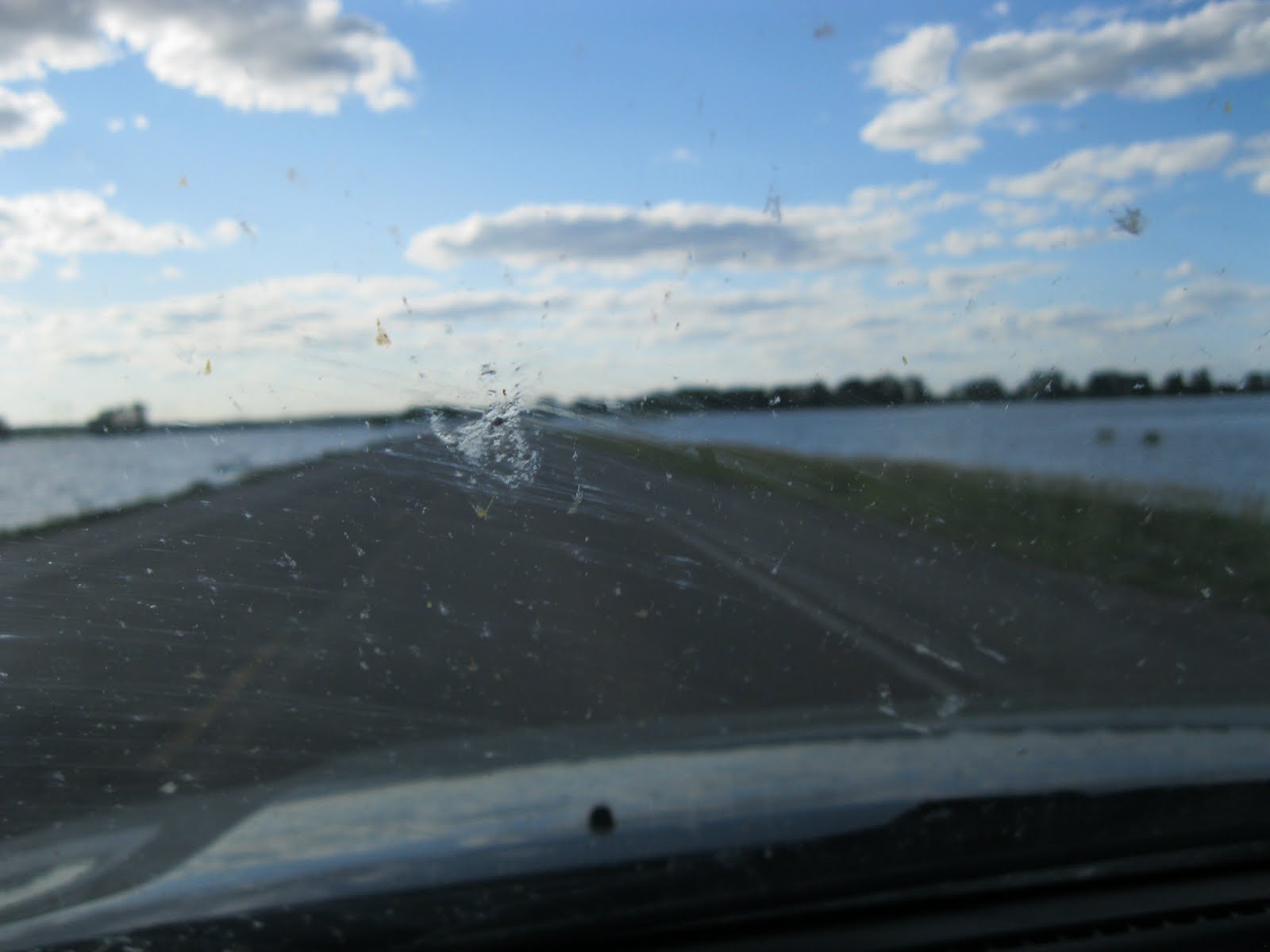
I’m on my way to Browning, home of the Blackfeet Indians. I see the mountains out there in front of me loud and clear.

 |
| sorry about the windshield glare |
Mountains have big spirits. . . if only we would stop to feel it. I wonder how many days the pioneers saw the mountains before they reached them. There they are, still snow capped over the lush green fields. I am going to see trees soon! I love the smell of mountain firs. It is nice that although I am in flat country once again, the vanishing point in front of me on the straight road is the mountains. I stop and read the sign about the Blackfeet tribe.
 |
| click on the pix, and it will enlarge so you can read! |
Mileage 2701. I come to Interstate 89, which leads south to Great Falls. Well, there are no great falls anymore, the river has been dammed. No more fabulous fish jumping over the great falls. Sad. But we know where they so recently were. A sign says “Crosswinds,” because this is a road condition. There is a wind sock straight out, winds from the south west. I pass the Blackfeet College and a large office building for the Bureau of Indian Affairs.

And then lots of little tiny houses. A sign “Drinking and driving leads to empty lodges. The alcohol spirit is real.” I see the Blackfeet Trading Post, and know I would have spent money there if only Yoko would not have roasted in the car. She is good for my wallet (when we are not at the veterinarian’s office). Here is the Museum of the Plains Indians. I will come back here with my granddaughter. . . without the dog, and spend the day. There is much to learn. And a sign. . . only 12 miles to East Glacier. Almost to one of the best National Parks in the country, and the gateway to the other side of the Rockies. Sadly, the Indians are living in a low economic situation. Here is a large housing project in the city limits. And then, we are out in the country again. . . big ranches with horses. Sign: Blackfeet Nation Bison Preserve.
 |
| cattle on the Blackfeet bison preserve |
I get excited when I see dark spots and slow down to take a picture. When I enlarge it. . . they are cattle. Not bison. Do cattle and bison live harmoniously together? Hmmmm. . . Then I go over Two Medicine River and I am in East Glacier! 2723 miles on the odometer. Trees! Trees! Route two here is beautiful. I zip under the railroad bridge into the park for a few minutes to take a picture of the imposing Glacier Park Lodge, one of several grand old hotel lodges in the park. It is gorgeous. Built by the railroad barons themselves.
 |
| Railroad underpass to East Glacier |
 |
| red vehicle on left is a "jammer" tour bus, Glacier Park |
There are campers and motorcycles on the road as we travel west on Route 2. . . . this is Marias Pass, “discovered” in 1889 after a long year of tramping around in the wilderness looking for it by a railroad surveyor named Frank Stevens. But he didn’t really discover it. . .he had an Indian guide, of course. http://en.wikipedia.org/wiki/Marias_Pass
The Continental Divide! Elevation 5216.
I stop at a waterfall, and turn in at the Goat Lick to see if I can see any mountain goats licking salt off the cliff today. Yes, two. . . very far away.
 |
| snowmelt falls galore |
 |
| see human, below, and then know the size of falls |
 |
| click to enlarge, and see goat in center of cliff |
 |
| now she has jumped to the left with her baby kid |
I get back on the highway, and there is a whole flock of goats lying right there by the side of the road, chewing and staring at the tourists who are staring at them. I couldn’t get a picture, was trapped between moving traffic, and it was too late to pull over. Oh well. Rushing rushing rushing streams, snow melt, fresh air, beaver dam, snow fields, avalanche sheds over the railroad tracks, the train running above my head now as the road shoots down. . The bear grass is blooming, white pom poms waving in the breeze. I pass the Isaac Walton Inn, which is another famous railroad stop. You can stop there on Amtrack! I come to a tic-tac-toe grid of nine white crosses. It must have been a bus. Or two loaded cars hitting head on. I cringe. I see some motels that are doing well, and others that are closed and for sale. It’s a short season here, and very hard to make a financial go of it. But if you need a strategy to lose money, what a nice place to do it. I pass by Stanton Creek, the Bar Café is doing well. Four more crosses and wreaths. Jersey barriers on a sharp curve! Unheard of in Montana. Someone of note must have driven over the cliff. Now I see the Middle Fork of the Flathead River. . . again. . . I passed by it at the Goat Lick. It is still raging beside me. The water looks like gray green milk. Normally it is crystal clear. Magnetic blue lupine blossoms along the highway. Smashing! A red vintage Jammer tour bus drives by . . . driven by the same driver I had last year when I went up the mountain. Scroll back to Summer 2010, and you’ll find the post of that fabulous trip. I am leaving the area of Glacier Park now, have just passed the Belton Chalet at the west entrance. And I gas up in Hungry Horse. My last fill up, I am almost finished traveling. Gas here: $3.58 a gallon. Odometer: 2786. Now I am in the Montana I have lived in on and off since 2007. The south fork of the Flathead River is beside me, and it has covered the flats that people normally stand on to fly fish. No fly fishing for now, too much turmoil and silt in the water. The Flathead River is dam controlled at the south end of Flathead Lake, so although it is boiling, it is not flooding like the Missouri River is. Five white crosses just before the House of Mystery, where the Montana Vortex is advertised to reside. They are busy today, lots of cars in their lot. I turn left at Big Sky Water Park, and head for Bigfork. Fifteen minutes later I am seeing the Swan Range that pushes up to the sky on the east side of Flathead Lake (which is about as big as Cape Cod Bay). I take the appropriate turns and talk to my daughter on the phone. She and the granddaughter are grocery shopping for me. NICE! I turn again at Echo Lake Café, and then I pass by the swollen Echo Lake. The snow melt has really caused a sensation on the lake, the causeway is closed to traffic because it is two feet under water. Luckily, I don’t have to cross it. I drive down Sherman Lane. . . my road and pull up at my western home. Tipi in the yard to greet me. Mileage: 2817. Yoko has been standing in the passenger seat with her paws on the window ledge for the past ten minutes. She knew just where we were. Of course. We have arrived! And the peonies are in full bloom for us. Groceries coming shortly, and the people I want to see. Wonderful. I turn off the key. Well done, little 2001 Toyota Highlander!
 |
| The finish line! We have arrived! |
If you’ve read this far, and you think this was long, you may blame it on my friend Marie Reilly. She told me to get off the Interstates. Well, I did, and there was much more to comment upon. Much more!
The territory I've covered in the past two days, above.
Sunday, July 3, 2011
July 2, North Dakota and Montana!
 |
| Russ Meads and his new pizzeria in Williston, ND |
 |
| This place is going to rock |
 |
| Another transplanted Cape Codder |
 |
| All new, booths now almost completed! |
July 2. . . Odometer reads 2233 at the beginning of the day. Fireworks for sale along Route 2 (the Highline) at roadside stands. Some closed early in the day, but they open later. I am driving from Williston, North Dakota to. . . I was hoping all the way across Montana, but it became apparent that I wouldn’t make it. . . the road is not an Interstate, and there are many places to slow down. . . every town along the “High Line” has there 25-35 mph speed limit, as they should. In between towns you can go for miles at 70 mph. But I get distracted by the towns. And I stop a lot.
I started the day by eating breakfast with Russ, the self-deployed to Williston son-in-law. We ate in the very nice breakfast restaurant at El Rancho Motel, which happens to be a very nice motel in downtown Williston, built in a quality manner in the 60’s or 70’s for the oil industry clientele, a very nice stay.
http://www.elranchomotel.net/
http://www.elranchomotel.net/
A large sports bar makes it a comfortable place to relax after a day on the road. Yesterday afternoon, at the hour when Applebee’s was full to capacity with “rough riders” just off the hard work week, the El Rancho sports bar was comfortable and not rowdy. Just what I needed. Russ showed me his new about-to-open-in three-weeks pizza place, which is located at the airport and right next to Applebee’s. It’s large enough to hold a lot of people. I am happy that he and his partners have found a great location to put out the top quality pizza he knows how to produce. Did I mention that a lot of these oil crews and truck drivers are living in travel trailer parks, and that passes as “housing”? It’s true. These guys are working hard and making good money. There are thousands of them. Gas is not cheap in spite of the oil biz, it is $3.70 a gallon here. They will love the great pizza.
I left Williston behind, and soon passed over the Montana border. A sign announces that the white crosses indicate highway fatalities. There is no wondering where people die on the highways of Montana, the sites are clearly marked. I’m following the Missouri River, and if you know your history, this is the Lewis and Clark trail. They would be floored to see the oil tanks out across the landscape; sure, there is agriculture, with a mixture of farm silos and oil tanks. But many ranches have given up that because the oil wells and tanks take up so much space. I see abandoned houses, one blue one here that is boarded up but was recently lived in. .. broken cars from the 70’s in the yard. It used to be a ranch, but no longer.
 |
| Can see for so many miles ahead |
 |
| The mix of agro silos and oil wells and tanks |
 |
| There's oil in them there fields |
Today most of the trucks are not running, thank God! They are locked up, many of them, behind chain link fences, and the guys are home for the Fourth Weekend. I am so lucky! But any tourist trying to follow the Lewis and Clark trail out here will have the amazing challenge of driving with the rough rider truck drivers. I count five bicyclists during the day. . . one solo and two couples. They must be nuts, I think. There is no breakdown lane, and the trucks don’t slow down to pass them by. Eeeeeek! But it is beautiful. . . the grass is green and waving in the wind, the sky is blue, the yellow wild flowers are blooming. And sometimes I pull over and shut off the car just to listen to the birds, because they are all busy mating and nest guarding and hopping and tweedling.
 |
| vintage permanent wave machine, yikes! electrifying! |
 |
| A bar and a lady of the evening |
 |
| No bar? make your own hootch |
 |
| Prarie fashion through the ages |
 |
| The way we used to shop for groceries |
And before that, the pioneer days. So much stuff in here. A very nice woman following me around and telling me things, showing me how the old washing machines worked, and telling me about the people who wore some of the vintage clothing. My odemeter reads 2276. I’ve only gone 40 miles today. I better get moving. I get into the Sioux Reservation, there are several towns along the High Line that are reservation towns, and I feel sorry for the people living along the highway because starting here it is totally ripped up on the right shoulder for miles. It looks like they are going to put in another lane, but that will be miraculous, because the terrain is very hilly and will require so much fill. Millions of dollars of yellow construction vehicles are parked along the side of the road, all crews gone for the weekend. One front yard is cut right in half. They’ve lost most of their front yard. There are lots of white crosses along the side of the road at every intersection. I start counting crosses, but give up after awhile. I had gotten to 24. There is a large housing project at Fort Pick. The Poplar Hospital has a sign out front that says, “Walk in Balance.” Good advice. I stop soon and take a picture of an abandoned church. It seems very lonely, and it is not the first lonely church I have passed. The fields around it seem to go on forever. There is only one house in sight. The railroad tracks run along parallel to the road, so every now and then I see a train come towards me. They are slow moving today, without many freight cars. The land becomes very flat, and I can see the badlands over to my left, the south. Here’s a sign. . . “Chose the Right Path, Don’t Drink and Drive.” Very good advice.
I pass the Wolf Point turn to the south. Mileage 2331. How could it be that I have only traveled 100 miles? I keep stopping at any gas station for a cold ice tea. It is hot. The land is green, but dry. I am at a higher elevation. Crops here are not growing very fast at all, and the oil wells have faded away someplace behind me. I come to a historic point and stop to read the sign. Tragic. In 1837, a steamboat owned by the American Fur Trading Company made its way all the way up here, and the crew carried small pox. You guessed it, whole tribe wiped out. I imagine more people lived up here in 1820 than live here now. Barely a human to be seen. Anyway, almost the whole “Little Girls Band” of the Assiniboines died.
The tribes still mourn that catastrophic loss of life. I see alfalfa but no grain on the sides of the road. But here is a huge silo going up, a construction project. I wonder what will go into it. There are yellow flowers growing on each side of the road, and I have to try my point and shoot technique. Cruise control is on at 65. I can see for miles ahead sometimes. I come to the Fort Peck exit. The river is overflowing here, flat and lazy. But too full. I fill up twenty miles later just for the fun of it in Glasgow, I only need 6 gallons because I really am having a hard time making time today. Ah, in Glasgow the tell-tale signs of the Missouri up in people’s yards. .. a gray covering of silt. So it is receding here. It has been worse.
The tribes still mourn that catastrophic loss of life. I see alfalfa but no grain on the sides of the road. But here is a huge silo going up, a construction project. I wonder what will go into it. There are yellow flowers growing on each side of the road, and I have to try my point and shoot technique. Cruise control is on at 65. I can see for miles ahead sometimes. I come to the Fort Peck exit. The river is overflowing here, flat and lazy. But too full. I fill up twenty miles later just for the fun of it in Glasgow, I only need 6 gallons because I really am having a hard time making time today. Ah, in Glasgow the tell-tale signs of the Missouri up in people’s yards. .. a gray covering of silt. So it is receding here. It has been worse.
 |
| Yes, I turned off the highway. |
 |
| A sea of grasses |
 |
| someone mows but nobody goes |
 |
| My buddy, the choo choo. |
 |
| Thank you, tree |
 |
| I am buzzed by seagull |
I am not kidding. I am a Cape Codder, and I know seagulls. There has to be a large body of water south of me. Seagulls always find large lakes, don’t ask me how. But this one is definitely cruising me for potato chips. Smart, but I don’t have any. Now a new river, the Milk River, runs through the little town of Hinsdale. By the way, the Canadian border is not far to the north. Every now and then I come to a road with a sign that says “Canada” pointing to the right. North.
I slow down for Saco. This is really a very old town with an old store front and a little old church. The tracks pass through, and ancient wooden grain elevators say, “we used to be somebody.” No one here anymore, except for a few cars at the bar. Back in the green hills, a Norse boat goes by me on a trailer. Wow. That was weird. I see bee hives at the Robinson Ranch. That’s good. Wow, am I going road-crazy? No, just noticing details. I come over a rise and see the mountains ahead of me . It’s the first time I’ve seen a mountain range west of the Mississippi. Maybe this is the Bear Paw Range. I’ll have to look that up. Not the Rockies yet. Malta goes by. Or I pass through Malta. The US Border Patrol has an office here. And there are a few more little museums. About the dinosaurs, I hope. They lived here. Hard to believe. Dodson, small small town. 71 miles to Havre. OK. I’m shooting for Havre. My husband is concerned, back in Massachusetts. He has made a reservation for me and the dog. The dog. The dog. The lady at the museum in Culbertson came out to see her. She asked if I was lonely, and I said, “I have a god. I mean, a dog.” So, naturally, the lady had to come out to the car (which was in the shade) and see if I had a god or a dog. Yoko always wags her tail. She does. Oh good, found a link for the precious Culbertson Museum. http://www.culbertsonmt.com/museum.htm
 |
| Yoko, are you a god or a dog? |
So. 70 miles to Havre. I listen to Canadian public radio. I love the call letters. DNTO. At first, I thought it was some Native American name I’d never heard, because a Native American (Canadian. . . Canada is in North America, right? So is Mexico, by the way).. . a Native American elder was talking about the use of the four biggies. . Tobacco, sage, cedar and sweet grass. . . and how those four things are sacred and how they are used to honor. They honor just about everything from the earth to venerable humans to spirit. Very good. That is why I thought he was saying Dee-en-ti-oh. But it was really DNTO. A good radio station, by the way. The next topic, which took me all the way to Havre, was about trees, with different people of all sorts telling about their significant-encounter-with-a -tree story, whether it was Christmas tree, or tree that grabbed their soccer ball and would not give it back, or tree that was going to be chopped down but was 300 years old so they raised money to change the route of the highway, or lady who lives up in a tree, or whatever, all great tree stories. I do like trees. I have been looking for them every time I stop so I can park under them. Thank you, trees.
Approaching Fort Belknap. . . something high on a hill. I think it is a large pink house from the distance. I get closer, and it is a church. Closer still, it is a large abandoned church. How sad. Here is the cemetery, on the hill facing the highway. So many gravestones. So many lost ancestors. Where are the descendants now? Not here. I cannot take a picture but I bet I can find a picture of this church, it is so very scenic. It is five miles before Fort Belknap, if you want to find it. I have traveled 2489.7 miles. So far. Ah, here is a shot of the church, and more great shots from the region I’ve covered today. Perfect. Thank you, photographer who shares photos. http://www.flickr.com/photos/mwahlsten/3743440847/
Here are some more: http://maps.google.com/maps/place?oe=utf-8&rls=org.mozilla:en-US:official&client=firefox-a&um=1&ie=UTF-8&q=church+near+Fort+Belknap,+MT&fb=1&gl=us&hq=church&hnear=0x533fd5e76a8d0d4f:0x214b830612525e88,Fort+Belknap+Agency,+Mt&cid=13893056355221473599 Worth looking at!
I am leaving the reservation. The mountains are south of me now. I am being followed by two couples on Harleys. They were ahead of me, but they stopped to take off their leather jackets. So now they are behind me, and happy with that, apparently, because they have not passed me. I see a sign that says, Havre, 21 miles. I am almost done driving today.
 |
| The road coming in to Havre |
 |
| Good thing I have all-wheel drive |
OMG! A chance to go four-wheeling. The road surface is gone here, and so is the road crew. Free for all! Dust everywhere. Lots of ruts in the road, and sand wallows. I am following a camper trailer now, and he almost gets stuck. My little all-wheel-drive 4-cylinder Highlander just plows right through. I watch the Harleys in my rear view mirror, because I am only doing 25 mph, and have plenty of time to watch them. The car is driving itself through the sand wallows. Good little tractor, this car. The Harleys don’t dump. That’s good. They have dropped waaaaay back, though. Their arms will be sore. I know. I do have a motorcycle license in my wallet. Do not tempt me, or dare me. I will use it. I will. Those people on Harleys took off their helmets some time ago (I got jealous) to let the wind blow through their hair, and also smell the sweet white blossoms on these trees. . . oh, do they smell sweet. I will have to find out what they are. And here I am. In Havre. I made it. There is a buffalo jump here. I will visit it tomorrow. Time for a nap. Trip almost done. Glacier National Park tomorrow. And then I am almost to Bigfork.
I am here:
http://www.townpump.com/index.aspx/hotels Thank you for keeping me company.
Saturday, July 2, 2011
Made it to Moutain Time, July 1
 |
| Chasing windmills |
Made it to Mountain Time. I am on the west side of North Dakota, made it across the state yesterday, and boy is the Missouri River full of itself. But I’ll get to that. . . Here’s a map for you to ponder:
http://en.wikipedia.org/wiki/File:National-atlas-north-dakota.PNG
First, I left Fargo late morning. I was frustrated with the fact that my hotel’s Internet was down, so I drove to their “sister” hotel and sat outside in my car for twenty minutes trying to get on. But no. So, never mind. Yoko and I gassed up, and the town smelled like oil, so yes, gas was a little less expensive. . $3.39 a gallon. My mileage: 1810. About a thousand miles to go to get to Bigfork, MT. And lots of challenges ahead. This whole trip has been one opportunity to solve problems after another. Today. . . floods ahead. I called Minot and talked to a few hotel receptionists. The scene still sounds really bad up there regarding their flooding Souris River, so I altered my route and abandoned my Trip Tick.
Set out on I-94, and immediately was hooked on the possibility of seeing a white buffalo at the Pioneer Village in Jamestown. Something to head for. Now I am really starting to feel like Don Quixote, because I am seeing more windmill (wind turbine, to be correct) blades being pulled by semi’s. I am sorry if you are sick of this topic. But this whole thing fascinates me. And more so later in the day. . . you’ll see why. Anyway, the sky was huge, because now I am truly in the West. And not blue, really, but all sorts of blue grays, with a big thunder storm to my south. I watch it for hours over there, with lightening zapping down out of the sky. But, it is miles away from me. In Castleton I see a schizophrenic plane, or maybe a suicidal plane, and he is buzzing power lines, just making it over them, and then going down and almost touching the ground and them popping up over more power lines on the other side of the huge fields. Oh. It’s a crop duster. You have to be mad to be a crop duster pilot. The things sprays when it’s about thirty feet from the ground, and he (or it could be a she) just flies along spraying and then takes off just in time to keep from frying on the power lines . . . OMG. I had to stop watching. There is no corn here, so I don’t know what the heck he/she is spraying. Random canola fields. . . they are beginning to display the bright yellow that canola can achieve. . . the railroad is running parallel to I-94, and many coal cars heading east. Many. We are such consumers of coal, you have no idea. It’s so flat here it’s like looking across a table. I see a grove of cottonwood trees about a mile off, and I can see the sky on the other side of the tree trunks. My camera would never get the shot, so I didn’t try. You have to use your mind’s eye. The sky is full of water, I know it’s going to fall soon. The speed limit is 75, so naturally, everyone is going 85. I haven’t seen a Prius for several states. Hardly a green car in sight, except for a Ford Escape here and there. Toyotas are beginning to be scarce. . . this is true America.
About 40 miles from Fargo, I begin to see the rounding hills which mean there are large wetlands between them. Huge puddles, now, after their rainy spring. I see a bird in the water that I swear is a pelican. It could be, right? Probably not. It was not a crane, his bill was far too thick. Pelican in North Dakota. I swear. Go ahead, look up some bird and educate me.
All right , now here I am in corporate farm America. Miles and miles of fields and groups of huge silos here and there, but nary a farm house to behold. Huge combine dealership at one obscure rural exit that has no services. Except for a combine dealership.
I come to a sign Just before the white buffalo exit (her name is White Cloud), and it says Continental Divide, elevation 1490 feet. I believe the elevation. But not the Continental Divide part. I think that is way west out near where I’m heading in Montana. I’ve been to the Continental Divide in Glacier National Park, so how could it be here, unless it runs sideways for awhile. Maybe it does. Another question to ponder for awhile.
OK, I stopped at Pioneer Village. The sun was not beating down on the car, the sky was trying to rain, and I felt like Yoko would not cook in the car if I got out and looked for the white buffalo. It turns out that this little town of Jamestown, ND, is where many books were written. Look at my pictures, you will see who I mean as an author.


I think I read one of his books, and now may read another. There are lots of old vintage buildings here hauled in from around the county. It all seems so small against the hugeness of the sky. And those wind turbine blades I keep following. We have become a society that needs everything to be huge. White Cloud must have been chewing her cud down in the draw, near the creek. She wouldn’t come out of the tree grove, so I got no pictures. I bought a post card. The best thing about Pioneer Village today was the stagecoach. . . actually, it was the matched team of draft horses that trotted everywhere they went in perfect step. All this I oberserved in twenty minutes. I am a quick tourist. Time to get crackin’ again. . .
We come to a huge wetland that would like to cover the road. The highway department has put some kind of blow up barrier there, must have some sand in it. Everyone is trusting it and driving down to three feet below the water’s elevation. I do, too. That’s nothing. Just a puddle. The signs say Kidder County and Crystal Springs Lake.

 |
| driving below water level at a wetland |

 |
| Yes, I am obsessed with windmill blade transportation |


And I hit Bismarck, capitol of the state. Lots of exits to take, everything huge again. The Missouri River is waaaay over its banks. But luckily the highway is built up over it. I just wiz through. I stop for gas, get 9 gallons. I am obsessing, I do not want my gas tank to get below half full in these wide open spaces. I am at 2007 miles. So, almost 200 miles, almost 9 gallons of gas. I’m getting about 20 miles to the gallon in my little old (ten years old) Highlander, and that’s not bad, since I am pushing it to the max.
Post Bismark. . . hills beautiful hills. Big huge swirly clouds, grayish blue sky. Off in the distance, I see it! My first western windfarm. It must be fifteen miles off. It cannot bother anyone, there are no houses between here and God. It is over there capturing this wind that has been blowing me around forever. But what city will benefit? I hope Bismarck. Jim says the power melts away if it has to be transmitted hundreds and thousands of miles. I can see that.
So, to my left, New Salem, with a huge cow statue standing up on a butte. On the right (north) windfarm.
I stop at the last small city in ND before the state line and call around for hotels. Nothing. It’s the fourth of July weekend, and lots of rodeos, etc. The country people are all in town. I call my son-in-law who is up in the oil town of Williston, putting together a pizza emporium. He says give me f 15 minutes. He calls me back. . . has a room for me in Williston. I head north. I am OFF THE INTERSTATE.
So you have all heard of the Bakken Oil Fields. You use oil that comes from here. Sure you do.
I am driving up the east side of the Teddy Roosevelt National Grasslands state park, (http://en.wikipedia.org/wiki/Theodore_Roosevelt_National_Park) and the rough-riders are driving trucks all around me like maniacs. Full of oil, gravel, huge tanks, whatever. They all go about 70. They push the poor tourists along like a tidal wave. There is only one land on each side of the highway. There are no guard rails when we go up over a section of the badlands.
 |
| Yoko breathing fresh air in the Badlands. . . trucks wizzing by. |
It is as thrilling as a roller coaster ride. My windshield keeps getting hit with rocks falling off the trucks coming towards me. Now this used to be a wonderful grasslands area, with farms along the highway. It still is. Except now there is all this oil sucking going on, always was, in fact, but they have stepped it up with fracking. I pass campgrounds that are set up for housing. There are actual trailer encampments everywhere. The green fields full of steer are sharing acreage with huge tanks and busy little oil wells.


The gravel roads that cut squarely off the highway are full of these heavy trucks, making huge dust storms as they roll along not slowing down. When they pull out onto the highway, they are covered with dust. You can see sheets of dust hanging straight over these straight line roads as they go out to the horizon and the oil wells beyond. I see no windmills. My hands are not clean, I am driving, ain’t I?
So this goes on for about a hundred miles. I stop at a scenic over look and let a train of trucks behind me go by. They fly down the mountain so fast I cannot believe they actually make the turns. A touring motorcyclist who took the time to come up the east side of the grasslands drives by, his eyes popping out. He is followed closely by a 16 wheeler. It does not mix, the summer camper tourists and these huge truckers with their Star Wars mentality. I see no park rangers anywhere. I think they are hiding.
Approaching Williston, I cross the Missouri River again.


This time it it almost up over the road. I imagine it will wash the road out soon if more rain comes down. But the truckers just plow on, so no stopping. I shoot pictures out of the bug splattered windshield. In reverence to the river, and also the traffic signs, we have slowed down to 45 mph. I am here in Williston, Rough Rider capitol of the USA (sorry Texas). More men here than women, ten to one. And they work hard. All day. Applebee’s Restaurant is full of muscle men. No fat people here, not that I can see. OMG- Americans do have muscles. If they work. And it’s all lush and pretty houses (no for sale signs at all). And the city is nice, and you would never know the crazy route I just drove over to get here. Except, look there, at all those trucks parked outside every hotel. Good thing I knew someone who could get me a room, and now I am going to go look at his new pizza place. He’s going to make a fortune, I hope.
Subscribe to:
Posts (Atom)
